01
Vegetation Mapping
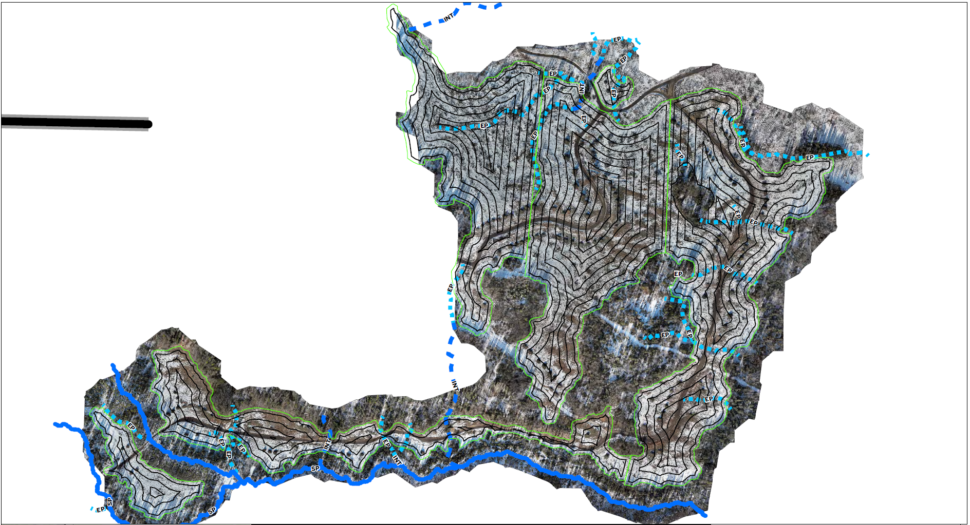
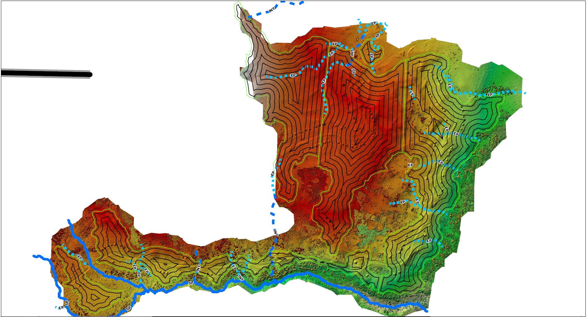
High-resolution aerial mapping using multispectral data to assess vegetation health, identify stress zones, and support IPM planning.
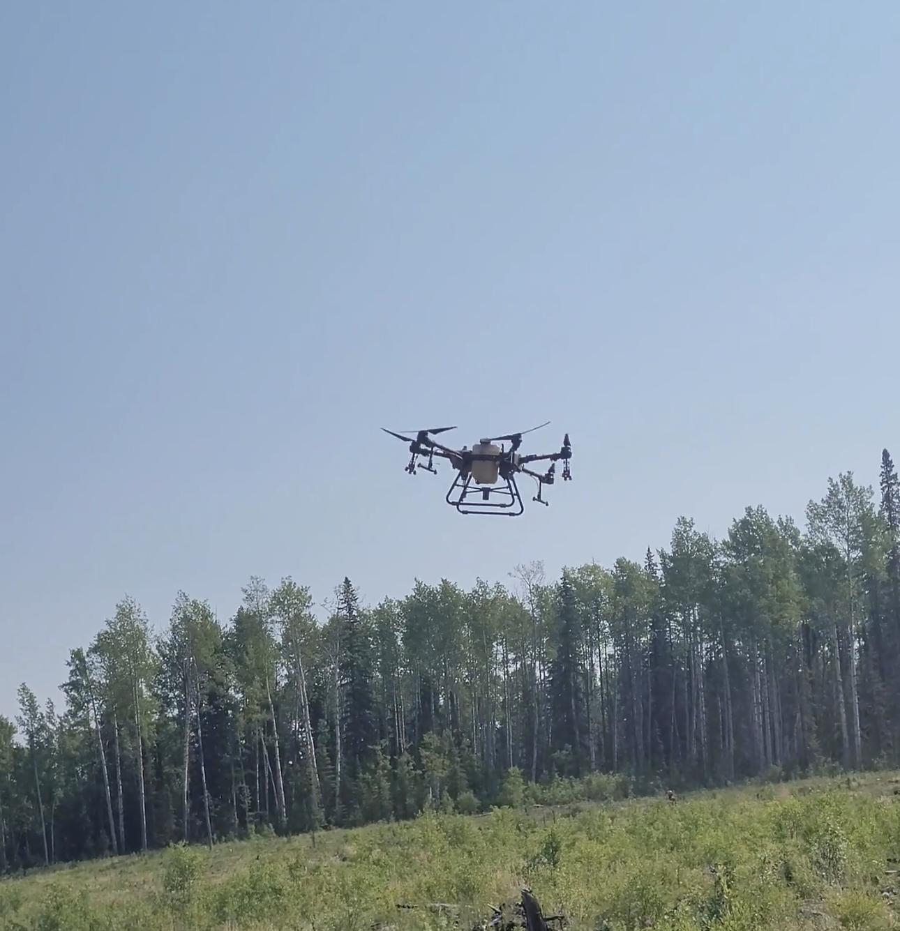
We provide advanced drone-based solutions for vegetation analysis, precision application, and site monitoring across industrial, forestry, and right-of-way environments.
Our UAV and GIS workflows support data-driven decision making, targeted treatment planning, and efficient coverage in remote or difficult-to-access areas.
High-resolution aerial mapping using multispectral data to assess vegetation health, identify stress zones, and support IPM planning.
GIS-ready maps, vegetation index outputs, monitoring data, and reporting support for planning, compliance, and long-term management.
Precision aerial application for herbicide spraying, revegetation, and reclamation seeding across remote or sensitive terrain.